Mangalore - Auction Details
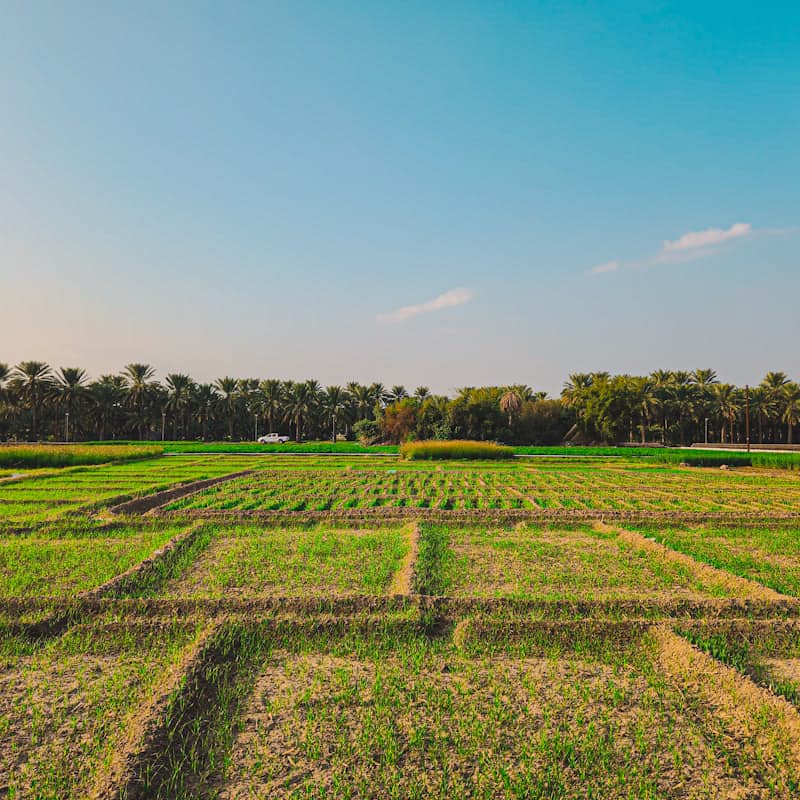
Land measuring 4.60 cents site No.5, S.No.11/2C(As per RTC 11/2 and as per sketch 11/2P) belonging to Arun Narayana Shetty. Boundaries: North:Portion of Same S. No., South:Road, East:Portion of Same S. No., West:Portion of Same S.no. auction.
Unlock unlimited access to all auctions
Get full auction details, contact info, and document downloads with a subscription.
About This Auction
Land measuring 4.60 cents site No.5, S.No.11/2C(As per RTC 11/2 and as per sketch 11/2P) belonging to Arun Narayana Shetty. Boundaries: North:Portion of Same S. No., South:Road, East:Portion of Same S. No., West:Portion of Same S.no.
Asset Details
Auction Details
Login to get 1 free download per month
Bank Details
Union Bank of India
Comments
Join the Discussion
Sign in to share your thoughts and questions about this auction.
Property Location
Loading map...
About Mangalore
Mangaluru, formerly called Mangalore, is a major industrial port city in the Indian state of Karnataka and on the west coast of India. It is located between the Laccadive Sea and the Western Ghats about 352 km (219 mi) west of Bengaluru, the state capital, 14 km (8.7 mi) north of Karnataka–Kerala border and 297 km (185 mi) south of Goa. Mangaluru is the state's only city to have all four modes of transport—air, road, rail and sea. The population of... the urban agglomeration was 619,664 according to the 2011 national census of India. It is known for being one of the locations of the Indian strategic petroleum reserves. Read More
Similar Auctions

Part and parcel of property situated in Theni District, Periyakulam Registration District, Kadamalaigundu Sub-district, Kadamalaigundu village, Uppodai pulam comprised in Survey No.559/3B, Sub division Survey No. 559/38, vacant land admeasuring 45.5 cents (6.25 ares) on west out of southern side leaving north-south 42 feet wide running east-west cart track on the north out of 77 ares bounded by Fast - Muthumancharan land (East), Land of Muthiah Thevar and others (South), 2 feet Cart track (North).
Theni District, Periyakulam Registration District, Kadamalaigundu Sub-district, Kadamalaigundu village, Uppodai pulam, Survey No.559/3B, Sub division Survey No. 559/38
Canara Bank
28 Apr, 2026
₹7,600,000
Reserve Price
₹760,000
EMD
All the peace and parcel of land having an extent of 0.2.12 Acres comprised in Re.Sy.No.26/3 in Block No.42 (old Sy.No.204/3B) of Thiruvaniyoor Village, Kunnathunad Taluk, Puthencruz Sub-District, Ernakulam District together with all rights and improvements therein.
Thiruvaniyoor Village, Kunnathunad Taluk, Puthencruz Sub-District, Ernakulam District, Re.Sy.No.26/3, Block No.42
Axis
20 Apr, 2026
₹1,946,154
Reserve Price
₹194,615
EMD
All that part and parcel of the property consisting of 0.0050 Hectares of Land and all other improvements thereon situated in R.S No.207/3part of Belur Village, Belur Grama Panchayat Hosdurg Taluk, Kasaragod District in the name of Sri K V Damodharan with boundaries as: East by: Property of Rathnakaran, West by: Property of Kuttyan, North by: Property of Sarojini, South by: Property of Kuttyan.
R.S No.207/3part of Belur Village, Belur Grama Panchayat Hosdurg Taluk, Kasaragod District
Canara Bank
06 May, 2026
₹126,000
Reserve Price
₹12,600
EMD
Agricultural land, Situated At Survey No. 175/1 & 175/2, Village- Divi, Dhule- shindkheda, Area: about 26400 Sq. Mtr
Survey No. 175/1 & 175/2, Village- Divi, Dhule- Shindkheda
Insolvency and Bankruptcy Board of India
24 Apr, 2026
₹2,410,155
Reserve Price
₹241,015
EMD
Agricultural land of Dalpatbhai Gordhanbhai Gohil bearing Khata no. 307, Old Survey No. 3449, Village Pantyadara, Taluka Vagra, Dist. Bharuch. Total Hectare- 2.05.
Village Pantyadara, Taluka Vagra, Dist. Bharuch, Khata no. 307, Old Survey No. 3449
Indian Overseas Bank
14 May, 2026
₹1,730,000
Reserve Price
₹173,000
EMD
Equitable Mortgage of Plot No.l9, out of N.. No.l/3 at Mouza No.270, P. No.38, Mouza Bhojapur, Ward No.7, within Limits of Gram Panchayat Manapur, Ramtek., Tah Ramtek, Dist Nagpur.
Plot No.l9, Mouza No.270, P. No.38, Mouza Bhojapur, Ward No.7, Gram Panchayat Manapur, Ramtek., Tah Ramtek, Dist Nagpur
Bank of India
28 Apr, 2026
₹1,224,000
Reserve Price
₹122,400
EMD
Non Agriculture land, GPM Property No.044, Gat No.604(Part), Ghogargaon
GPM Property No.044, Gat No.604(Part), Ghogargaon
Punjab National Bank
28 Apr, 2026
₹1,881,000
Reserve Price
₹188,100
EMD
ITEM NO. 1: Vacant Land with extent 2.70 Acre. Boundaries: North - Vacant Land, South - Karswood estate, East - Land sold to Jayaprakasam, West - Vacant Land.
3/72-A, Gundada, Thandhanad Area, Kotnagiri, THE NILGIRIS 643 277
Canara Bank
28 Apr, 2026
₹4,420,000
Reserve Price
₹442,000
EMD
EMT with MODTD registration of open non-agricultural land in Sy. No. 983/A/2, measuring 7.00 Gts. Kodad Town & revenue limits, Kodad Mandal & Municipality, Suryapet Dist. Boundaries: North: Land of kattekola Pullaiah & Road, South: land of Keetha Laxmamma & Road, East: Land of Vemuri Mohan Rao, West: Land of Kattekela Pullaiah. Property belongs to Sri Devireddy Bala Venkata Reddy.
Sy. No. 983/A/2, Kodad Town & revenue limits, Kodad Mandal & Municipality, Suryapet Dist
Canara Bank
28 Apr, 2026
₹9,410,000
Reserve Price
₹941,000
EMD
All that part and parcel of Arazi no 528/2 situated at Mouza -Harwara , Pargana & Tehsil -Sadar Dist-Prayagraj (U.P) area 336.00 Sq. Mtr. Bounded By: EAST- House of Phool Chandra, WEST- Graveyard, NORTH- Graveyard, SOUTH- |2 Feet wide Kaccha Rasta
Arazi no 528/2 situated at Mouza Harwara, Pargana & Tehsil Sadar, Dist Prayagraj (U.P)
Canara Bank
28 Apr, 2026
₹20,453,000
Reserve Price
₹2,045,300
EMD
Agricultural land situated within Chamuluru Village Fields and Grama Panchayat, within SID of Singanamala and RD of Anantapuramu. Survey No. 05/2, Actual Extent 4.43 Cents.
Survey No. 05/2, Chamuluru Village Fields, Singanamala SID, Anantapuramu RD, Anantapur
Union Bank of India
30 Apr, 2026
₹8,700,000
Reserve Price
₹870,000
EMD
Property situated at Sivagangai District, Karaikudi Registration District, Karaikudi No.1 Joint Sub Registrar Office, Karaikudi Taluk, Pallathur Panchayat, Kothari Group, Pallathur Village. Surveyed as: 1) Survey No 231/18- Punja land -0.20.0 Hectares- 49 cents, 2) Survey No 231/16- Punja land -0.20.0 Hectares- 49 cents, Survey No 231/17- Punja land -O.20.0 Hectares- 49 cents. Total Extent (Survey No 231/16, 231/17, 231/18) 147 cents. Four Boundaries: North: Punja land S.no231/15 owned by Rengasamy, South: Punja land S. No. 231/18 owned by S.Vadivel, East: Punja land S.No.232/2 owned by Government and Vaikal and Cart Track and Punja land S.No. 232/3 owned by O.M.Gopal, West: Punja land S. No. 231/8 owned by M.Kasinathan and punja land owned by PL. Periyasamy.
Sivagangai District, Karaikudi Registration District, Karaikudi No.1 Joint Sub Registrar Office, Karaikudi Taluk, Pallathur Panchayat, Kothari Group, Pallathur Village, Survey No 231/18, 231/16, 231/17
Canara Bank
30 Apr, 2026
₹8,350,000
Reserve Price
₹835,000
EMD
No comments yet
Be the first to share your thoughts about this auction.